|
Murphy's Law: Just In Case GPS Dies As an expedition kayaker I need to have respectable navigation skills. I only remember being sufficiently confused one time, and taking a "wrong turn" while kayaking, it cost me more than an hour, and I almost missed the tides, worse it turned a long day into a very long day, and in the end I was exhausted. Luckily, the weather turned sour only as I was paddling the last mile, and while the water became dangerous, I had some protection, and only a short crossing. Then the weather stayed bad for a couple of days leaving me with time to recuperate, and rest. Navigating from a kayak is difficult due to the flat perspective, you exist in the waves, not above them. Getting there is always more than half the battle. 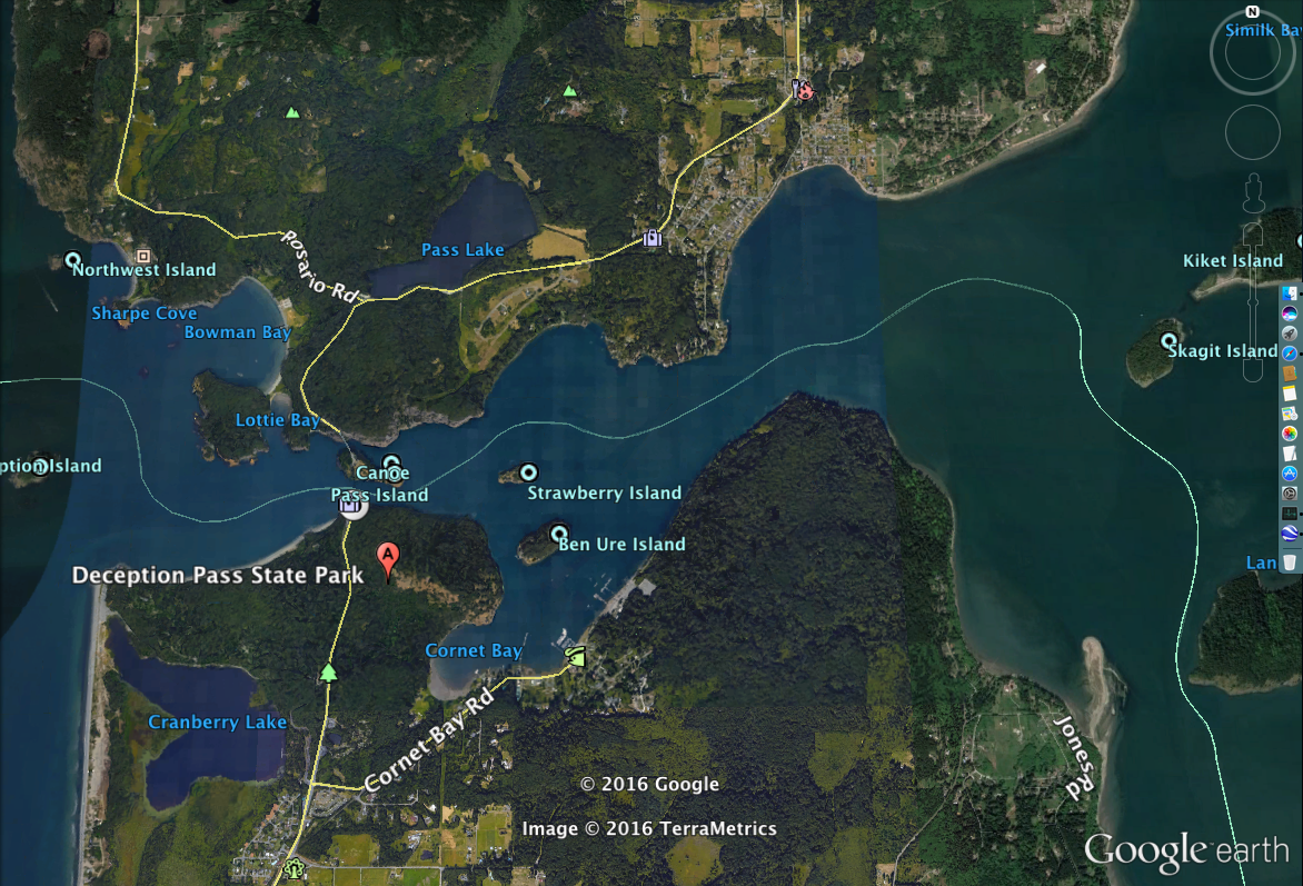 I made my mistake after leaving my camp at Ala Spit, which is the spit just east of Jones Rd. at the bottom right of the map. I paddled north, and made a navigational error after passing the first slight wave on the cape, I thought I had made the turn east, and I mistook Skagit Island for Ben Ure Island. (Note: My problem was I failed to check the compass attached to the bow of the kayak, and I just dead reckoned my position, and direction. I will never do that again. I made this after hundreds of days of navigating on land, and on water in kayaks, canoes, and other boats.) Instead of turning east, I slid north passing close to Skagit Island, and ending up in the dead end Similk Bay. Bummer. This added more than an hour (probably 2 hours but I can't recall) to the trip and required that I paddle full effort in order to make it through Canoe Pass, before the tide speed made the passage impassable. I made it just barely, the current was probably running 6-8 knots mid channel but I was still able to ride the eddies along the waters edge until I made it through Canoe Pass. Luckily the pass is short. Again, this require 90% to 100% effort.
Exhausted, I then shortened my paddle cutting off a number of miles, but forcing me to paddle a very long open water crossing from Allan Island past Bird Rocks to James Island, and then on between Decatur Island and Blakely Island. I was late and not expecting the upwelling problems I found out near Bird Rocks. There the water was standing 2' above the surrounding water due to strong upwelling. While I don't mind this kind of paddling, I try to keep it to a minimum when fully loaded, and tired. The upwelling was an area I estimate to be +1/2 - 1 mile in diameter, so I had no interest in paddling around it. In the end, I paddled about 8-10 hours at about 90%. I was very tired. There was one last crossing from the southern tip of Blakely Island to Frost Island with a strong wind directly from the starboard. While better than a following sea, the seas made the last mile difficult and dangerous. I was glad to slide into safe harbor at Spencer Spit State Park. This 90 day expedition had more bad weather days, and more technically difficult paddling days than good days paddling. It was the most emotionally difficult paddle of my life, with constant cold weather (a full week with high temperatures at 33˚ to 35˚ when I was prepared for lows of 45˚), high winds, difficult seas, and I was solo.
Comments
|
AuthorMaddog Categories
All
|
 RSS Feed